
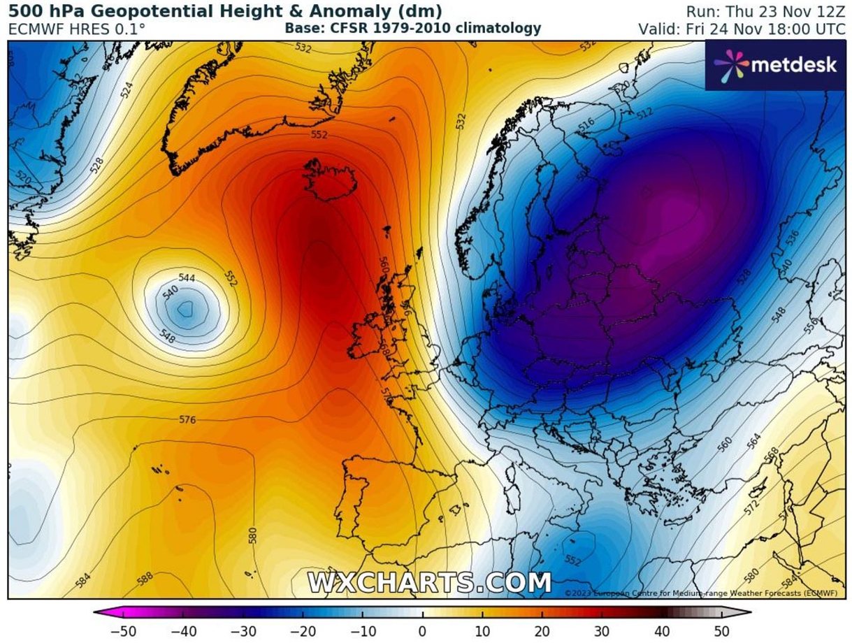
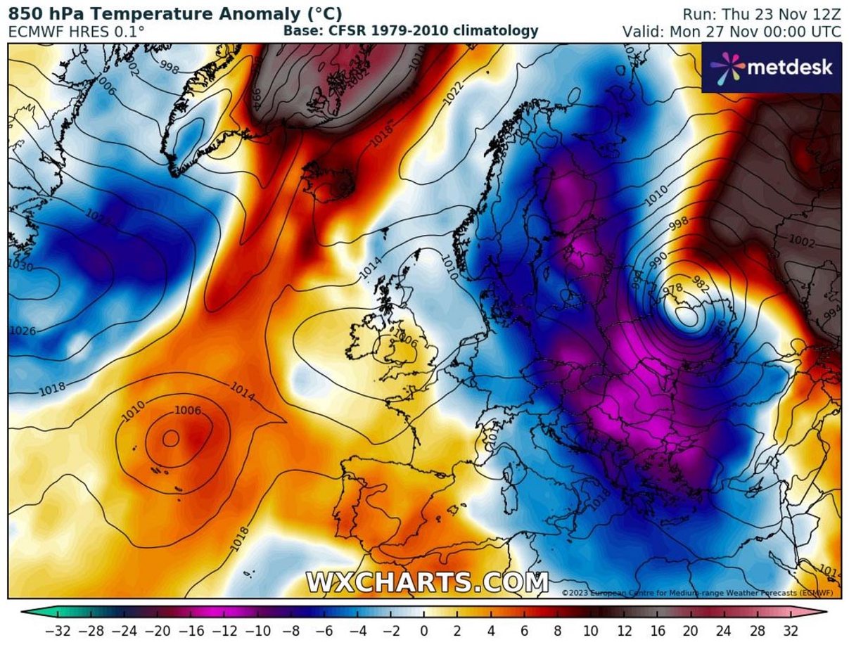
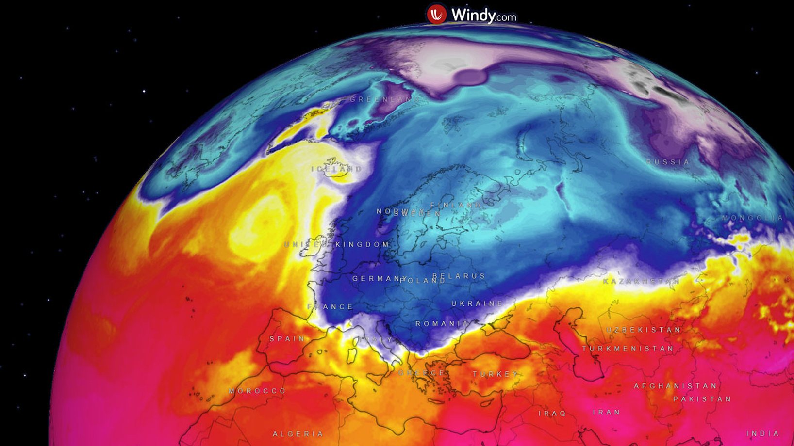
The weather is forecast to bring cold temperatures from the Arctic to eastern and central Europe through Saturday and Sunday, spreading further south across the Balkan Peninsula early next week.
According to Severe Weather, a severe winter storm will affect Greece, after which it will strengthen and become a major storm in Bulgaria, Romania, Moldova and Ukraine.

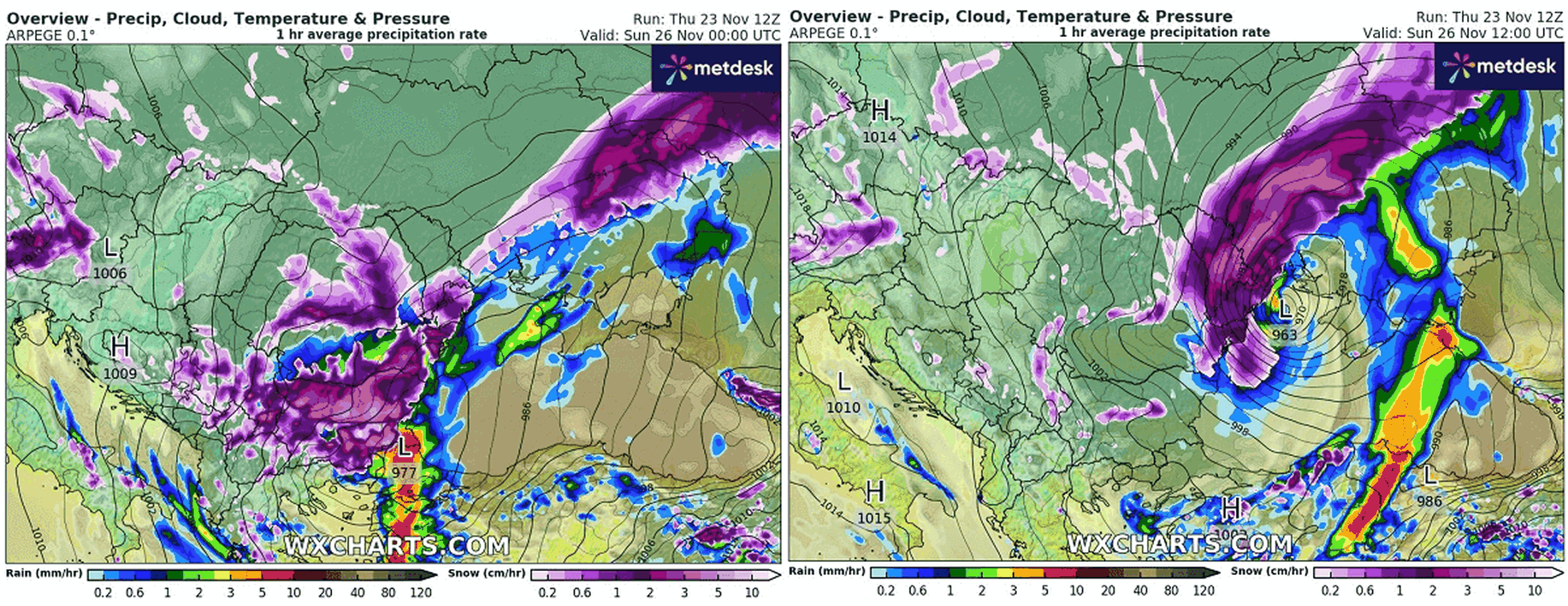
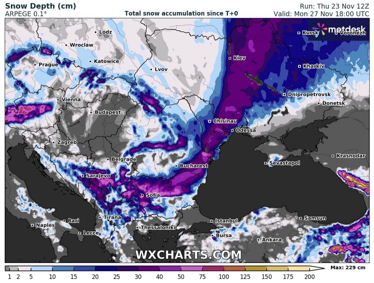
Meteorologists predict that the weather will be like this on Saturday and Sunday. Some snow is forecast to cover areas from Sofia to Bucharest to Odessa and Kiev in Ukraine. With about 50 centimeters of intense snowfall combined with strong winds.
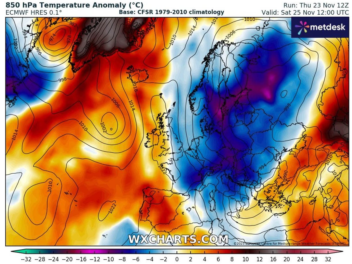
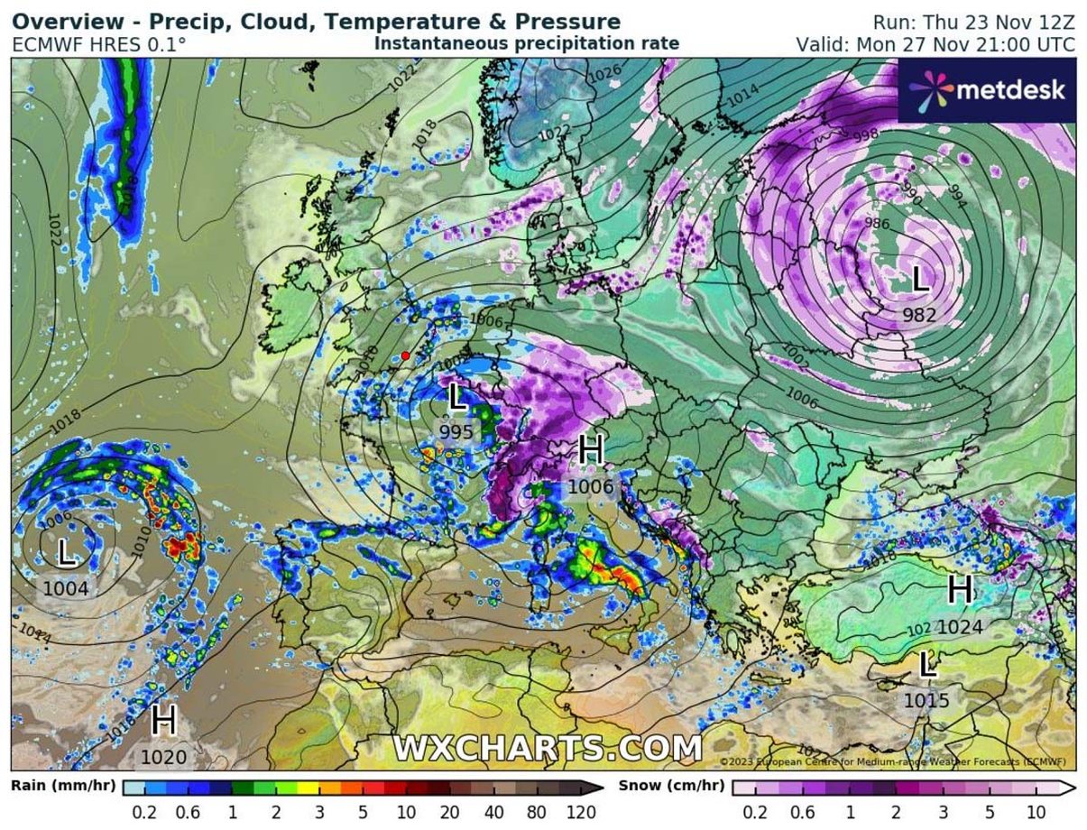
While temperatures in the west will remain close to normal, an arctic cold front will strengthen on Sunday and Monday across eastern Europe, especially in the Balkan Peninsula. Due to the Arctic front, the winter storm will form over Greece and the Ionian Sea on Saturday.
So the cold weekend will bring significantly lower temperatures than have been recorded recently, well below normal for late November.
A winter storm is coming to the Balkans
The winter storm will begin to strengthen on Saturday in southern Balkan countries, including Albania, North Macedonia, Greece and Bulgaria, with heavy rain and snow. It will also bring a significantly colder air mass to the Balkans.
The snow will be dense during the evening of Saturday, with the most intense snowfall in Bulgaria. Such weather will gradually spread to the northeast of the Black Sea and will become more intense by Sunday morning.
A new winter storm is likely to develop over the Benelux and travel towards the Alpine region from Monday evening into Tuesday. According to this information, there will be more snow and it will include parts of Western and Central Europe and the Balkan Peninsula.
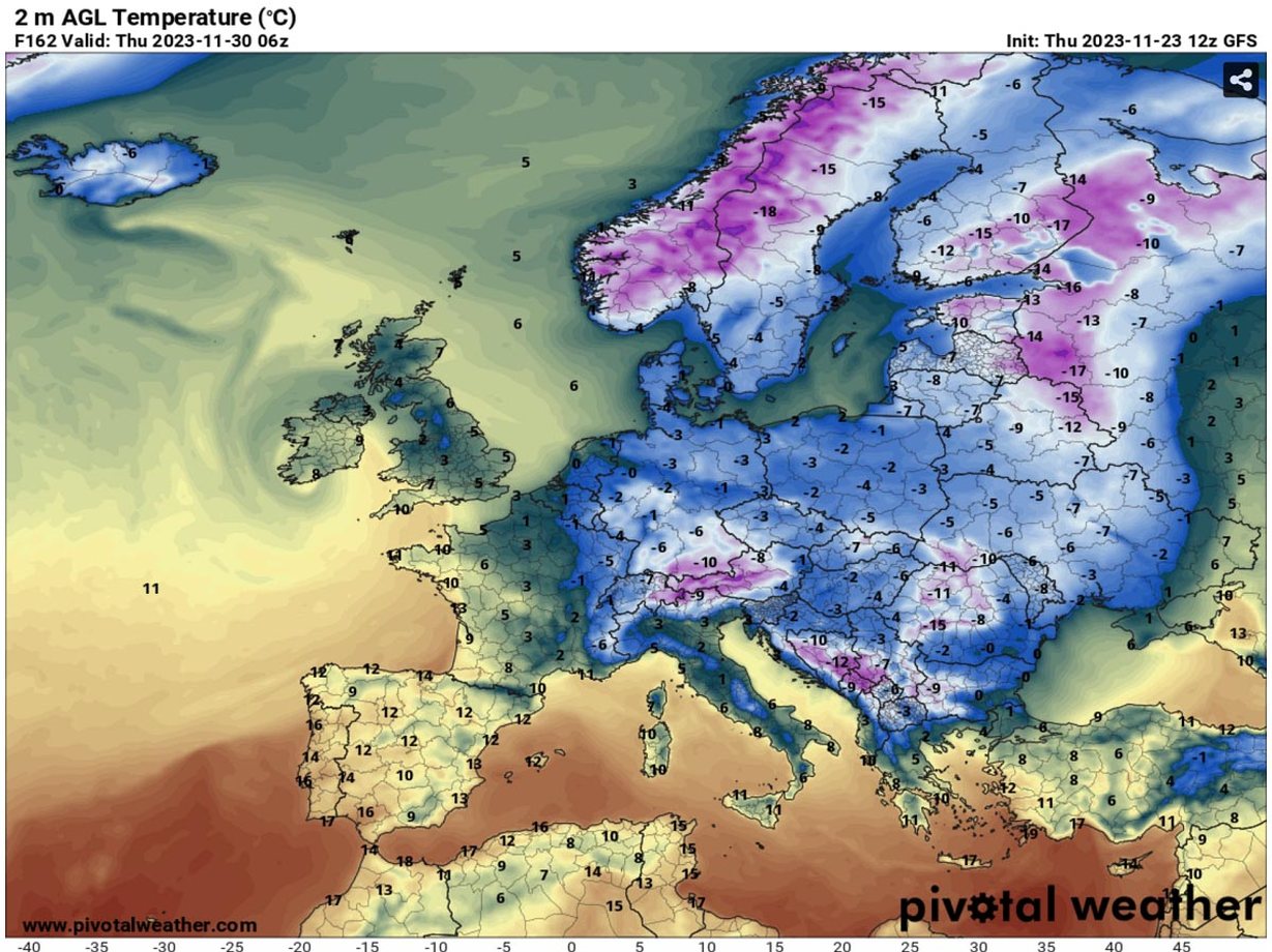
As the cold moves into Western Europe, snow is most likely to come. Snow is expected to fall over eastern France, the Benelux and Germany on Monday evening, then further east-southeast over the Alps towards the Balkans on Tuesday.
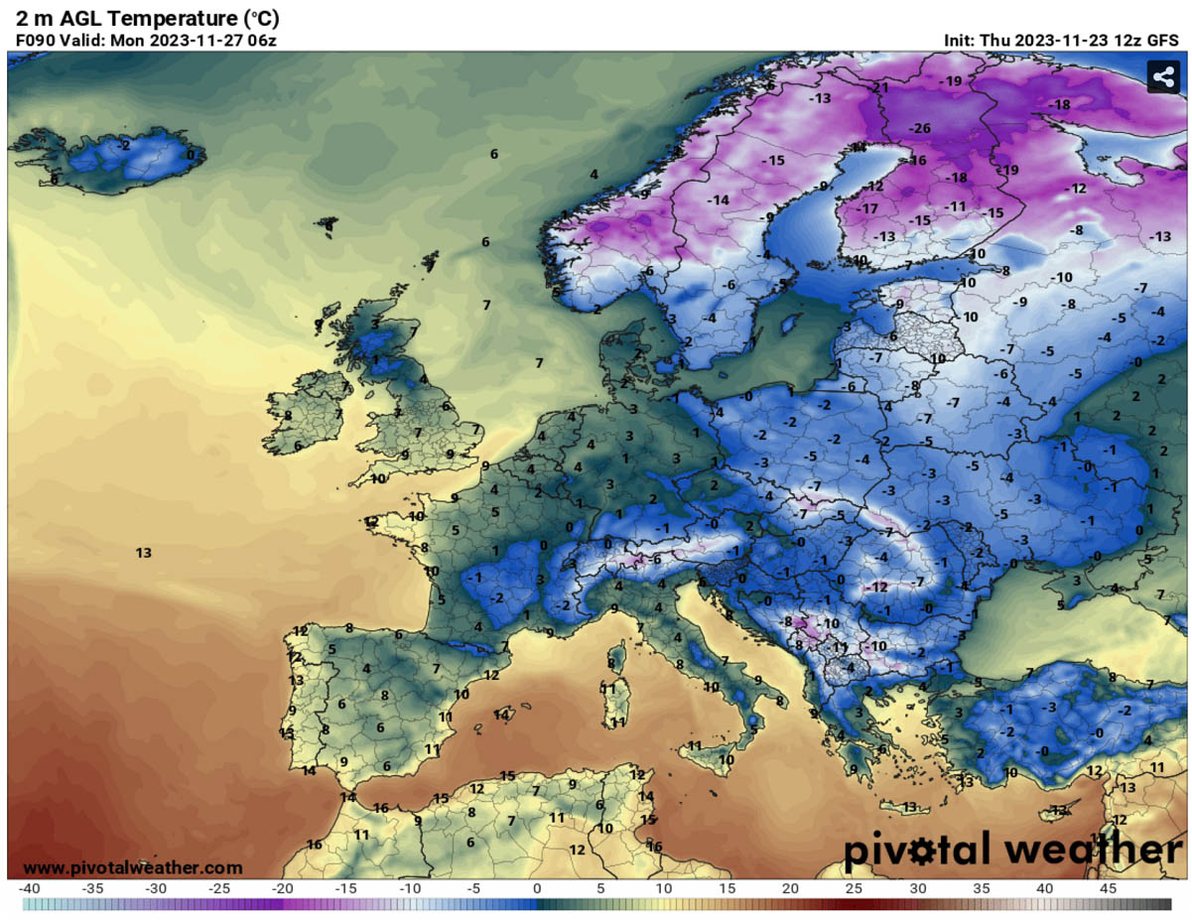
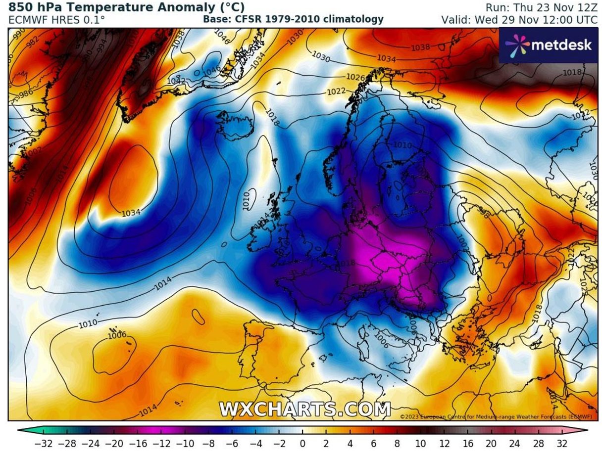
According to the forecast, Wednesday and Thursday mornings will be quite cold. There can be temperatures below -10 degrees Celsius. However, the most significant cold will remain over Scandinavia and the Baltic region. With temperatures of -20 degrees Celsius or lower.
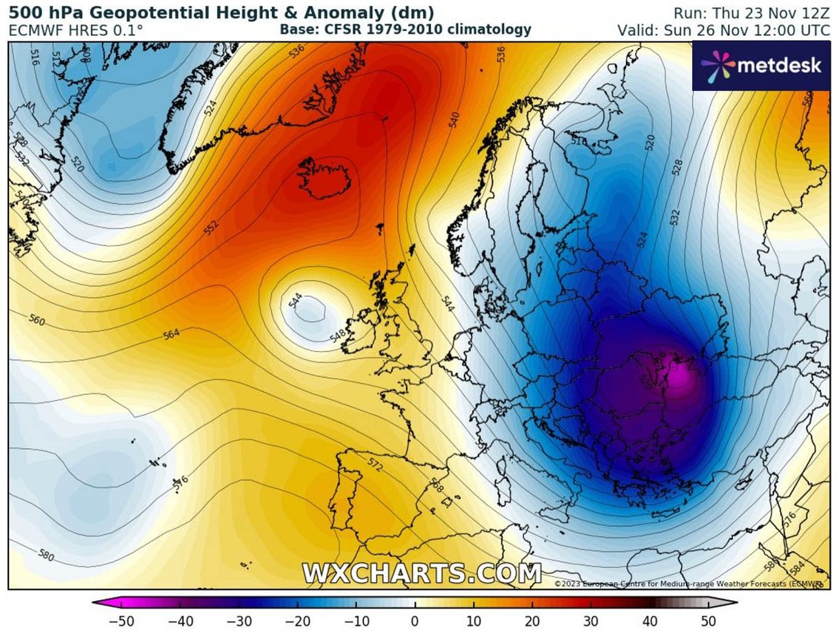
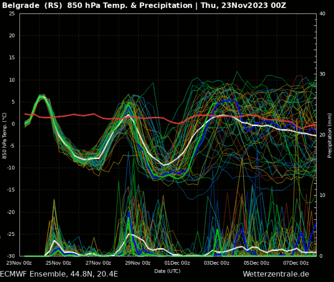
The first arctic front is clearly visible over the weekend (25-27 November), followed by a temporary warming, but an immediate re-cooling as the cold front strengthens again in the middle of next week, i.e. after 29 November. This period of significantly cooler than normal weather will significantly lower the average monthly November temperature for parts of Europe. (A2 Televizion)
A2 CNN Livestream
MUND TE LEXONI GJITHASHTU


